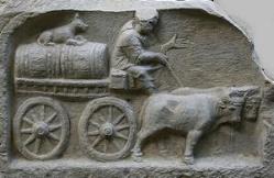
| Hinweis: ... wenn Sie im Detail sind, können Sie punktgenau in die Übersicht zurück springen, wenn Sie auf die Ochsen links unten klicken | ||
| Link zum BayernAtlas Oberdolling liegt ca. 8.500 m nördlich vom Limes bei Sandersdorf | ||
| Name | Kulturart | Herkunft |
| - | ||
| Berg | wohl keltisch | |
| Weg | wohl römisch | |
| Wald | wohl römisch | |
| Wald | wohl keltisch | |
| Äcker + Wald | wohl keltisch | |
| Gewässer | wohl keltisch | |
| Äcker | wohl römisch | |
| Äcker | Hüttenhausen | |
| Leite | wohl keltisch | |
| Äcker | wohl keltisch | |
| Stadtplan | wohl römisch | |
| Wald + Äcker | ? mehrfach | |
| Wald | wohl keltisch | |
| Berg | wohl keltisch | |
| Wald | wohl römisch | |
| OT | - | |
| Äcker | wohl römisch | |
| Äcker | wohl römisch | |
| Römerstraße | römisch | |
| Leite | wohl keltisch | |
| Leite | wohl vorrömisch | |
| Wald + Äcker | ? | |
| Äcker | mehrfach | |
| Äcker | Vohburg | |
| Äcker | wohl römisch | |
| Ort | wohl römisch | |
Quellen: BayernAtlas und Stadtplan, boari.de, November 2009 renov. 01.2019, update 10/2020 und 02/2022 | ||
Lateinische Sprachrelikte im bayerischen Dialekt
Flurnamen Oberdolling
Ur-Bayerisch ist keine Variante der deutschen Sprache, sondern Latein.
 Ö ha brrr